Agrodrone
Harnessing Drones for Sustainable Agriculture and Improved Food Access
Agrodrone set out to be more than another drone app: a real tool for precision agriculture. The technology was never the hard part, though. It had to make sense to the people using it. My work was the UX, turning complex user needs and real farming constraints into something intuitive and dependable.
When I joined Agrodrone, the team had little more than a concept, an early set of requirements, and the ambition to ship something new. My main goal was to bring those ideas to life and turn them into a production-ready concept: I owned the UI and steered the UX, working closely with stakeholders and bringing users into workshops and testing sessions so their needs shaped the design.
01
The solution
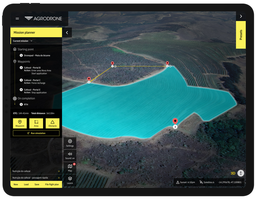
Agrodrone puts precision agriculture and a usable interface in one place. With the mission planning tool, users can map operational areas, start missions, get cost estimates, and adapt to live weather and terrain.
It also flags potential problems as they come up, handles regulatory compliance, breaks costs down, and gives full aircraft details next to detailed analytics, all in service of better food security and lower-impact farming.
02
What drone pilots actually need in the field.
In discovery, we ran interviews, workshops, and hands-on sessions with potential users. That gave us a clear read on the needs, preferences, and pain points of the people actually flying agricultural drones. From their daily challenges, we pulled out the core features they needed. The main takeaways:
- Tablet-optimized UI
- Comprehensive functionality
- Full-screen, distraction-free mode
- Transparent mission costs
- Detailed mission analytics and reports
- Minimize noise near humans and animals
- Control product dispersion (wind impact)
- Instant weather updates
- Regulatory compliance
- Intuitive setup and launch
- View fleet health and specs
- Support for diverse drone models
- Informative system updates
- 3D map visualization
- Customizable waypoint naming
- Adaptive speed and altitude settings
- Pre-mission simulation
- Variable application patterns
- Weather and fleet contingency plans
- Instant mission abort
- Real-time mission edits
03
What some of the solutions look like:
Integrated Mission Management
Start a new mission or load a previous one from a simple set of panels.
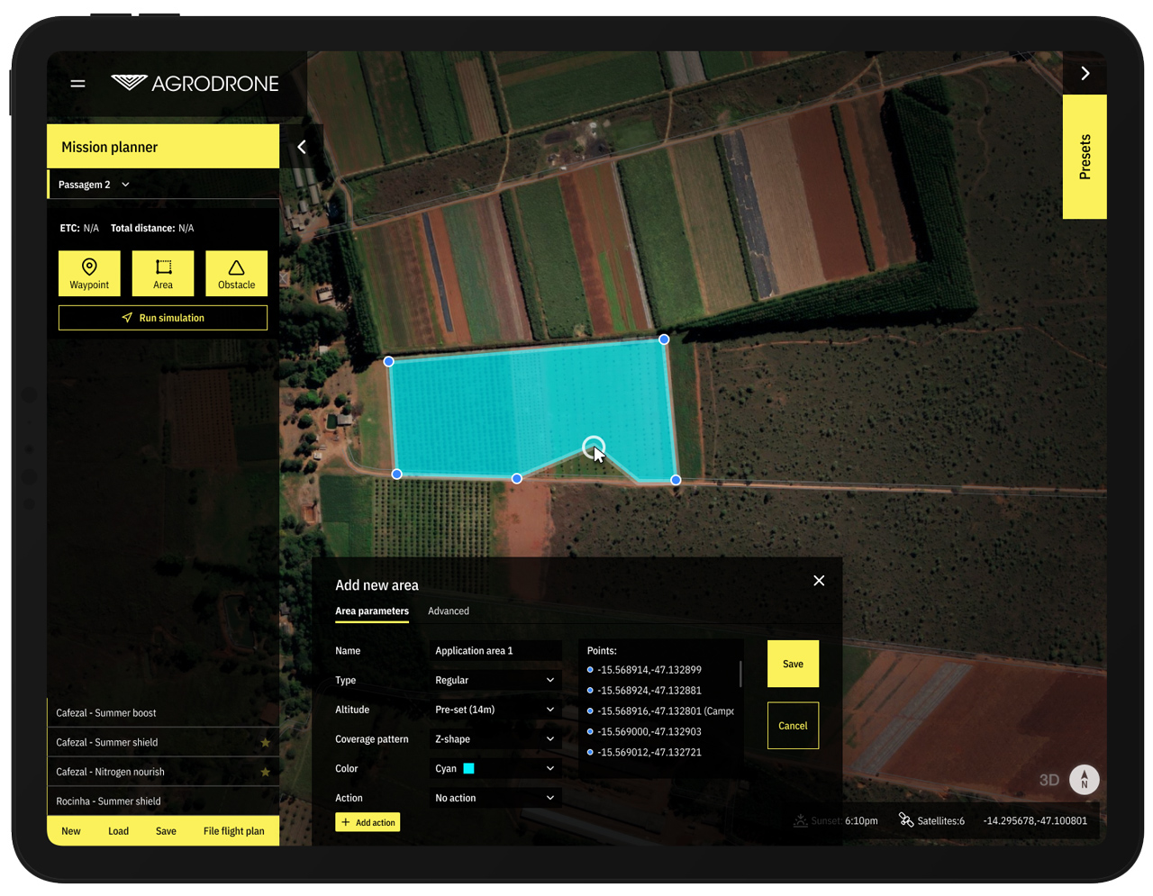
The interface lets users set waypoints with specific actions: adjusting altitude to cut noise near buildings or animals, changing speed, and controlling product application. When defining an area, they can also set detailed drone behavior, like applying products in a 'Z' or circular pattern, or at varying speeds.
Missions can start right away, run on a schedule, or be tested in simulation first, whatever the operation calls for.
Dynamic Mission Control with Advanced Mapping
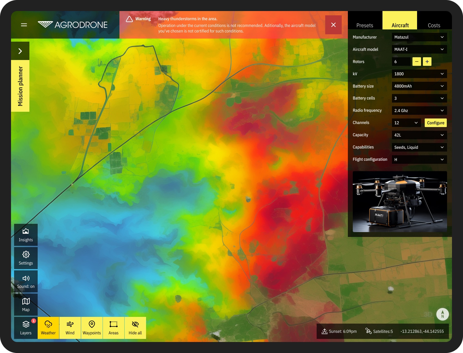
Mission planning runs on interactive maps built from high-quality satellite imagery. Layers for live weather and 3D terrain give the full picture before a mission goes ahead.
Users can switch between satellite sources to keep operations safe and efficient across different kinds of land.
Toggle panels and layers to balance visibility and detail.
Analytics and Insights
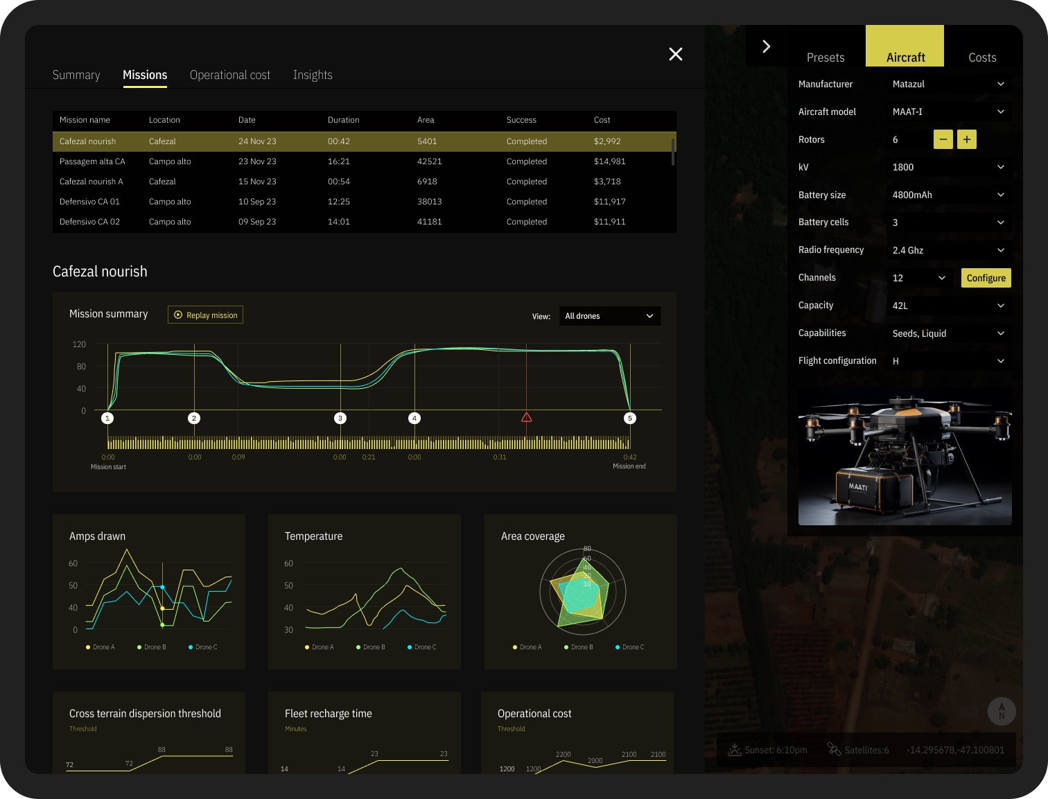
The analytics track more than live performance. They cover drone depreciation over time, area coverage, mission-to-mission comparison, efficiency rates, and incident tracking.
Users can also read trend lines, forecast mission outcomes, and use predictive analytics to fine-tune crop management and drone use. The dashboard is where most operational decisions get made.
Real-time feedback and compliance: alerts for potential threats, plus flight-plan filing with aviation authorities built into the system.
Settings and profiles: personalize the experience, manage permissions, and work through a settings menu organized around how each person uses the app.
Aircraft details: everything about each aircraft, from battery capacity, flight mode, and radio frequency down to product carry type and number of channels.
Cost estimation and analysis: a full cost breakdown before and after each mission, covering everything from fleet depreciation to product usage.
The aim was to pair Agrodrone's technology with an approach that worked for people at very different skill levels.
The final deliverable was a fully clickable prototype that accounted for the business requirements, user needs, and technical constraints.
The result was a more usable Agrodrone that landed well with stakeholders, investors, and users.