Agrodrone
Harnessing Drones for Sustainable Agriculture and Improved Food Access
Agrodrone isn’t just another drone application; it’s the future of precision agriculture. But bringing such a revolution to life wasn’t just about technical prowess; it needed a human touch. This case study dives deep into the UX processes that transformed complex user needs and agricultural challenges into an intuitive, robust solution.
The solution
Agrodrone revolutionizes precision agriculture by seamlessly integrating high-tech and user-centric solutions. With its advanced mission planning tool, users can easily map operational regions, initiate missions, get cost estimates, and adapt to real-time weather and terrain conditions.
Additionally, instant feedback on potential challenges, regulatory compliance features, cost drill-down, comprehensive aircraft details, and complete analytics and insights make Agrodrone a game-changer in boosting food security and eco-conscious agriculture.
Key discovery takeaways
User and stakeholder needs and desires
During the in-depth discovery phase of the Agrodrone project, our team conducted a series of interviews, workshops, and hands-on sessions with potential users. These explorations provided invaluable insights into the intricate needs, preferences, and pain points of those on the frontline of agricultural drone usage. By delving into their daily challenges and aspirations, we were able to distill a set of fundamental features and enhancements they desired. Here are the pivotal takeaways from our findings:
- Tablet-optimized UI
- Comprehensive functionality
- Full-screen, distraction-free mode
- Transparent mission costs
- Detailed mission analytics and reports
- Minimize noise near humans and animals
- Control product dispersion (wind impact)
- Instant weather updates
- Regulatory compliance
- Intuitive setup and launch
- View fleet health and specs
- Support for diverse drone models
- Informative system updates
- 3D map visualization
- Customizable waypoint naming
- Adaptive speed and altitude settings
- Pre-mission simulation
- Variable application patterns
- Weather and fleet contingency plans
- Instant mission abort
- Real-time mission edits
What some of the solutions look like:
Integrated Mission Management
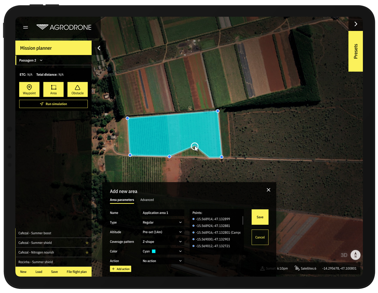
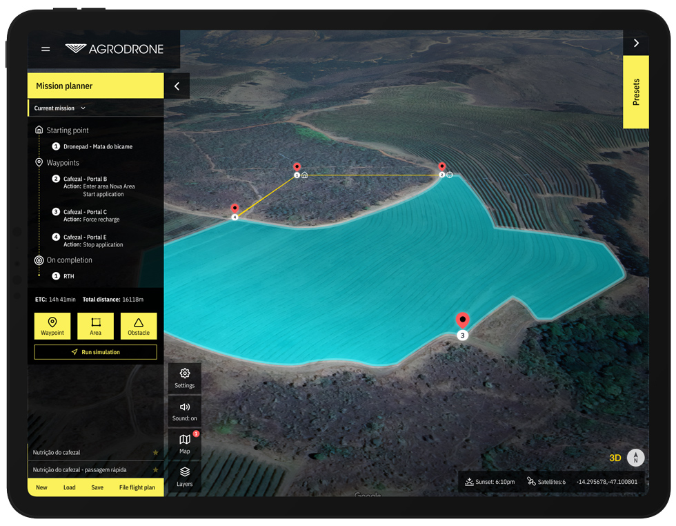
Initiate or load previous missions from an intuitive set of panels.
This robust interface lets users set waypoints with specific actions, adjusting attributes like altitude for noise reduction near constructions or animals, modulating speed, and controlling product application. Additionally, when defining areas, users can prescribe detailed activities for drones, such as applying products in ‘Z’, circular patterns, or varying speeds.
Whether it’s an immediate start, scheduled tasks, or simulation-based testing, Agrodrone provides the flexibility you need for efficient operations.


Dynamic Mission Control with Advanced Mapping
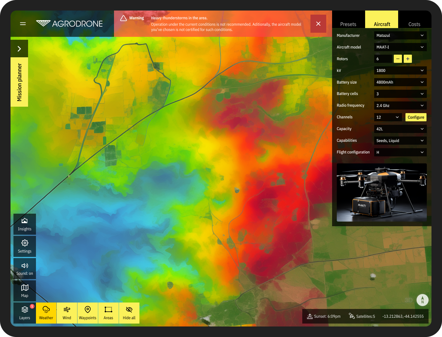
Experience enhanced mission planning with interactive maps derived from top-tier satellite imagery. Layers include real-time weather updates and 3D terrain insights, offering a comprehensive view for optimal decision-making.
Users have the flexibility to choose from various satellite sources, ensuring both safe and efficient operations across diverse landscapes.
Toggle panels and layers for an optimal balance of visibility and detail.
Comprehensive Analytics and Insights
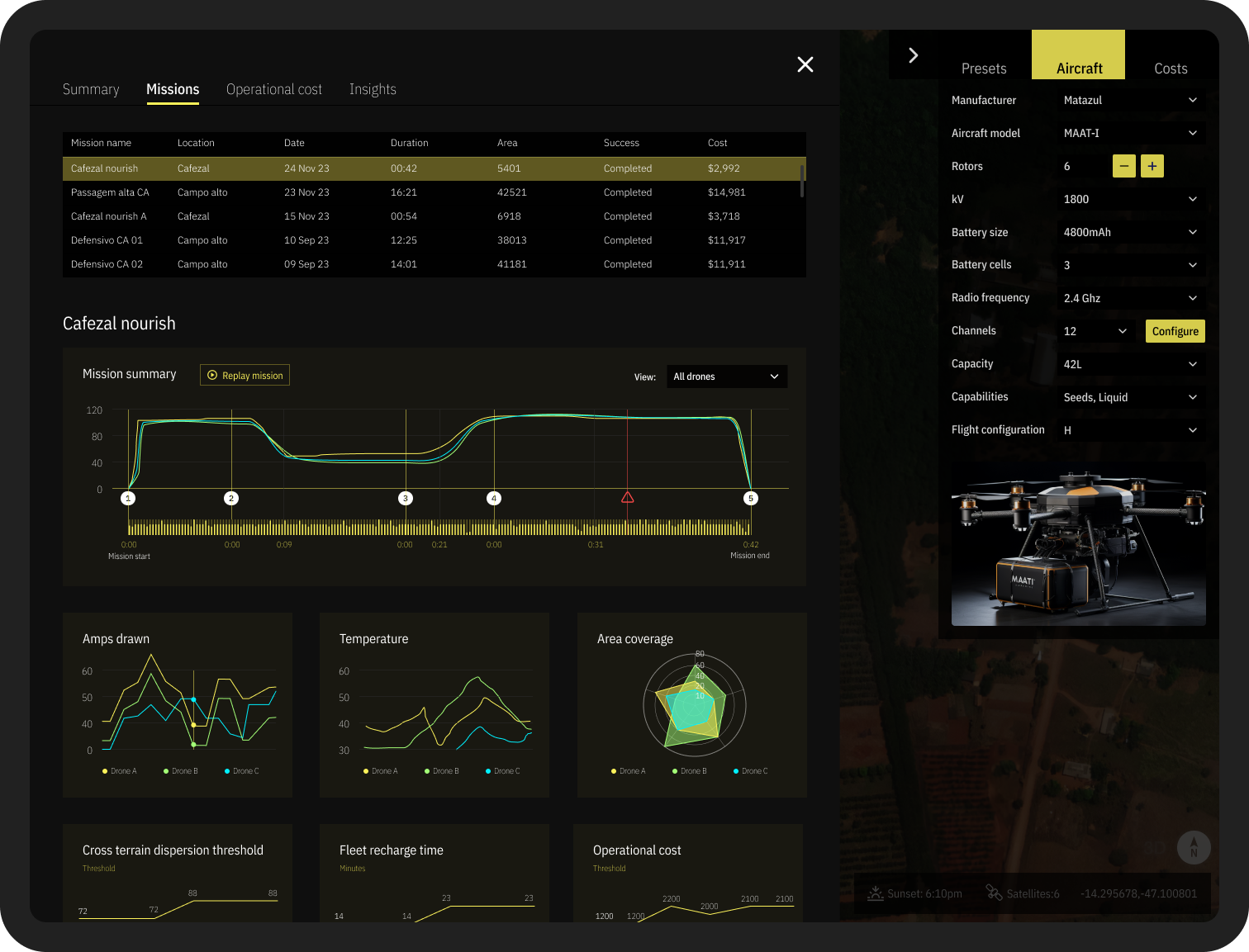
Agrodrone’s analytics go beyond just tracking real-time performance. They delve into detailed mission insights, such as drone depreciation over time, comprehensive area coverage metrics, cross-mission comparisons for performance benchmarking, operational efficiency rates, and the tracking of incidents.
With modern analytical tools, users can also observe trend lines, forecast future mission outcomes, and harness predictive analytics to optimize crop management and drone usage. This powerful dashboard serves as the nerve center for informed decision-making and continuous operational improvement.

Real-time Feedback & Compliance: Stay informed with alerts for potential threats and ensure safety by filing flight plans with aviation authorities, all integrated into the system for easy compliance.
Detailed Settings & Profiles: Personalize your user experience, manage permissions, and navigate a rich settings menu tailored to your specific usage patterns and app preferences.
Comprehensive Aircraft Details: Gain in-depth insights into each aircraft’s — from battery capacity, flight mode, and radio frequency to more granular details like product carry type and number of channels.
Cost Estimation & Analysis: Before and after launching a mission, gain a full view of the cost breakdowns that consider everything related to the operation, from fleet depreciation to product usage.
My role
When I was invited to join the Agrodrone project, the team had little more than a concept, an initial set of requirements, and an ambition to introduce an innovative product.
My main goal was to bring those ideas to life
and turn them into a production-ready concept.
I was responsible for creating the UI and steering the UX design of the product while also collaborating closely with the stakeholders, including users in workshops and testing sessions, and embedding their needs into our design philosophy. I helped create a vision that seamlessly merged Agrodrone’s cutting-edge technology with a user-centric approach, catering to diverse proficiency levels.
As a final deliverable, I made sure all business requirements, user needs, and technical capabilities were present in a final interactive, fully clickable prototype.
The outcome was a more user-friendly Agrodrone experience that appealed to stakeholders, investors, and users alike.

